Key Points and Summary: Tensions in the South China Sea continue to escalate as China strengthens its military presence, asserting its contested nine-dash-line claim.
-The U.S. has ramped up deterrence efforts, increasing freedom of navigation operations and deploying advanced Marine Littoral Units for island-hopping warfare.
EA-18G Growler. Image Credit: Creative Commons.
China’s Nine-Dash Line: Could It Lead to Armed Conflict?
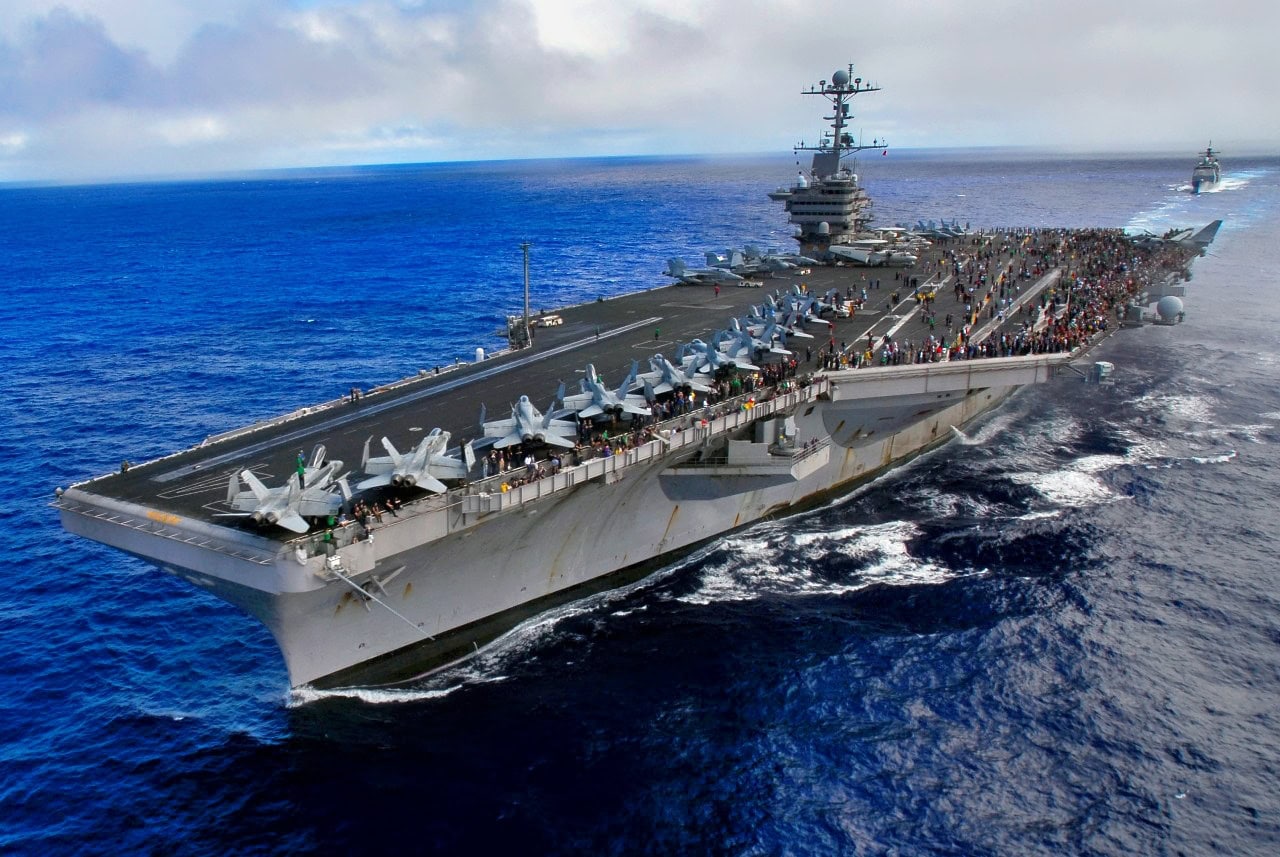
Dual carrier air attack operations, forward positioning of ISR (Intelligence, Surveillance, and Reconnaissance), and bombing assets, the addition of new bases in the Philippines, and the creation of specially configured United States Marine Corps amphibious Littoral Units are all specific measures the Pentagon continues to take as a way to “deter” China from quickly and suddenly taking over the South China Sea.
Taiwan, Indonesia, Vietnam, the Philippines, Malaysia, and others claim parts of the long-disputed Spratly Islands. Yet, for decades, China has asserted its famous “nine-dash-line” claim, suggesting it owns the entire area encompassing the South China Sea. The nine-dash-line Chinese territorial claim originated decades ago, yet the claim has been deemed inaccurate and unlawful by the UN Universal Law of the Sea Convention.
However, China says its territorial claim precedes the arrival of the UNLOS Convention and is more legitimate.
Air University explains the area of the nine-dash-line:
“The Nine-Dash line is an area outlined in and encompassing most of the SCS. It is so named because, on most maps, it is an outline of nine dashes creating a semicircular area stretching from the Gulf of Tonkin, south past Vietnam to Malaysia, and then northeast past the Philippines to just east of Taiwan. This area represents China’s territorial claims in the SCS, based on a similar line on a map issued and used by the Republic of China in 1948 to claim sovereignty and maritime rights in the SCS,” The Air University essay writes.
Longstanding Tension
The area remains contested to this day even though it encompasses exclusive economic zones of several Southeast Asian Countries. There has been an ebb and flow of tensions over the years, yet the issue is far from resolved.
For instance, the US Navy has conducted many Freedom of Navigation Operations, called FONOPS, designed to sail warships within a 12-mile radius of an island. According to the Universal Law of the Sea Convention, this is the distance to which a country’s land territory extends. By sailing within a 12-mile boundary, therefore, the US Navy sought to send a message that it does not recognize China’s territorial claims as lawful or legitimate.
China has also expanded its presence in the region in several key respects. Years ago, a US Navy P-8 Surveillance plane captured video of what the Pentagon called “land reclamation,” essentially a Chinese effort to engage in phony island building to add “land mass” to island areas to make territorial claims.
Risk of War in the South China Sea
Along with Taiwan, many continue to regard the South China Sea as a remaining flashpoint and risk area for potential conflict or miscalculation. The US Marine Corps, for example, is building a new light amphibious warship for island-hopping operations wherein forces and weapons will need to quickly transit from ship to shore to ship and engage in littoral, multi-domain warfare.
This shoreline need is part of why the Corps is creating specially configured “littoral units” prepared for island-hopping warfare and forming “Stand-in” forces capable of holding areas and operating within close proximity to coastal areas and enemy fire.
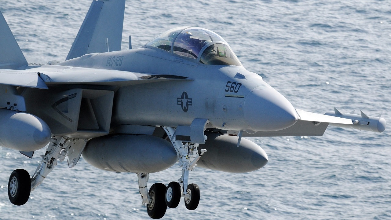
(Feb. 17, 2009) An EA-18G Growler assigned to the “Vikings” of Tactical Electronic Warfare Squadron (VAQ) 129 aligns itself for an at sea landing aboard the Nimitz-class aircraft carrier USS Ronald Reagan (CVN 76). The Growler is the replacement for the EA-6B Prowler, which will be replaced in the 2010 timeframe. Ronald Reagan is underway performing Fleet Replacement Squadron Carrier Qualifications in the Pacific. (U.S. Navy photo by Mass Communication Specialist 3rd Class Torrey W. Lee/Released).
China, however, has massively increased its presence in the South China Sea and even copied US “dual-carrier” training exercises in the Pacific. At one point in recent years, the People’s Liberation Army Navy (PLAN) sailed two aircraft carriers through the South China Sea together, operating in close coordination.
This show of force took place not long after the US Navy performed air-campaign attack drills with two aircraft carriers synchronizing sortie rates and maintaining connectivity. Such an approach can massively increase the scale and scope of any potential air campaign by essentially “doubling” the sortie rate.
China has also, at times, placed weapons, radar, and even fighter aircraft in disputed areas of the South China Sea. The continued PLA presence in and near the area can present significant risks to the US and Southeast Asian nations wishing to claim territory.
The PLA could, by design, be planning to create a no-access area for US and allied forces to operate.
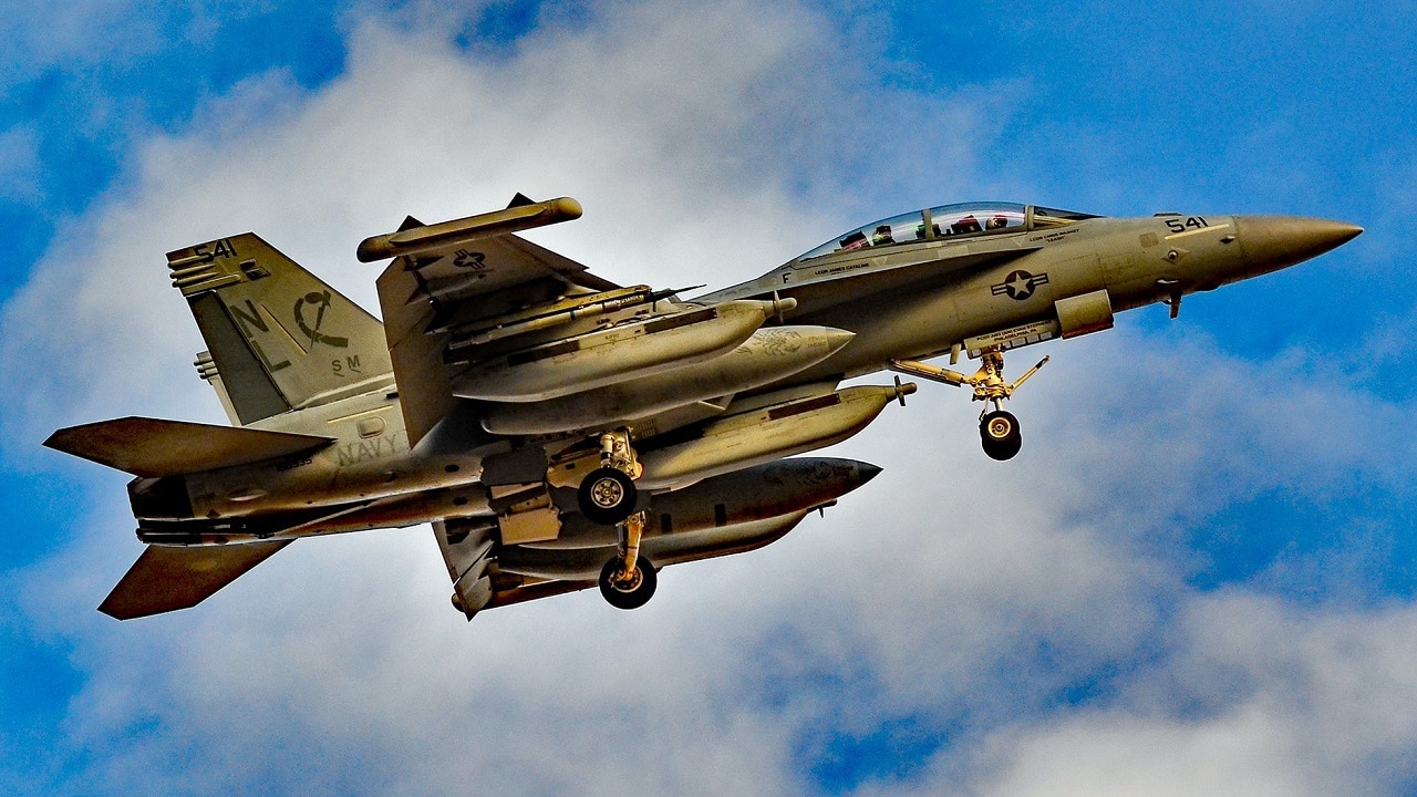
EA-18G Growler. Image Credit: Creative Commons.
About the Author: Kris Osborn
Kris Osborn is the Military Technology Editor of 19FortyFive and President of Warrior Maven – Center for Military Modernization. Osborn previously served at the Pentagon as a highly qualified expert in the Office of the Assistant Secretary of the Army—Acquisition, Logistics & Technology. Osborn has also worked as an anchor and on-air military specialist at national TV networks. He has appeared as a guest military expert on Fox News, MSNBC, The Military Channel, and The History Channel. He also has a Masters Degree in Comparative Literature from Columbia University.